For Road Information, call the Pima County Sheriff's Hotline: 520-351-3351
Back in April of 2016 I received an invitation from an internationally known travel writer, Gigi Griffis, to contribute content by way of interview for a travel guide she had in the works for Arizona. She was unable to use the interview for her current publication, but we agreed that it would make a good addition to Mt Lemmon AZ Images. So, here it is. BTW: Gigi's site is terrific, and you can subscribe to her blog with updates that arrive in your mailbox twice a week.
The guide below is offered just as that, a guide. I have done everything possible to be inclusive and complete, but I cannot guarantee that all the information and links are up to date. Double check times and days of weeks that restaurants and merchants are open; these can vary by season. I am open to any suggestions. Just go to my contacts page and send me a message.
Note that the really important stuff is Red and Bold! Anything in blue is a link to a website with more information.
The Basics
Summerhaven is a community nestled high in the Catalina range north of Tucson, and just below the peak of Mt. Lemmon. The mountain was named after Sara Lemmon, a botanist who explored the mountain on her honeymoon in 1881. For detailed sources on the history of the mountain and community see:
The original road to Summerhaven came up from Oracle to the north of the mountain. For many years it was unpaved and one way, with traffic controlled top and bottom by hour of the day. To this day it is still named The Control Road.
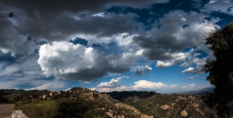
The current paved modern highway from Tucson south of the mountain was completed in 2007 after 19 years of construction. The image above was captured in August 2016 facing north at the Hoodoo Vista pullout, just north of Windy Point.
To get to the mountain from Tucson, pick up Tanque Verde Road at Grant and Kolb, drive east and north to the Catalina highway, and then north 5 miles to the base of the mountain. From the base it is 25 miles to Summerhaven. Speed limit is 35 miles/hour, slower on curves and congested areas. Speed limits are enforced, and the road is good but has sharp curves, so drive carefully. Use pullouts to allow faster drivers to pass.
There are no gas stations in Summerhaven, so make sure your tank is full before you leave Tucson. There is a gas station in the valley at Tanque Verde and Bear Canyon, just before you get on the Catalina Highway. There is an ATM at the General Store in Summerhaven.
- Suzanne Hensel, Look to the Mountains. Mt. Lemmon’s Woman’s Club 2006.
- Mary Ellen Barnes, The Road to Mount Lemmon, A Father, A Family, and the Making of Summerhaven.
The original road to Summerhaven came up from Oracle to the north of the mountain. For many years it was unpaved and one way, with traffic controlled top and bottom by hour of the day. To this day it is still named The Control Road.
The current paved modern highway from Tucson south of the mountain was completed in 2007 after 19 years of construction. The image above was captured in August 2016 facing north at the Hoodoo Vista pullout, just north of Windy Point.
To get to the mountain from Tucson, pick up Tanque Verde Road at Grant and Kolb, drive east and north to the Catalina highway, and then north 5 miles to the base of the mountain. From the base it is 25 miles to Summerhaven. Speed limit is 35 miles/hour, slower on curves and congested areas. Speed limits are enforced, and the road is good but has sharp curves, so drive carefully. Use pullouts to allow faster drivers to pass.
There are no gas stations in Summerhaven, so make sure your tank is full before you leave Tucson. There is a gas station in the valley at Tanque Verde and Bear Canyon, just before you get on the Catalina Highway. There is an ATM at the General Store in Summerhaven.
|
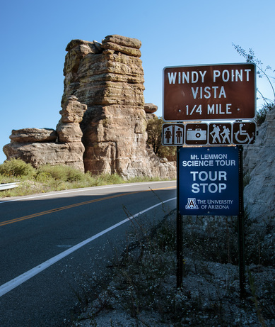
The University of Arizona College of Science has a smartphone app, Mt. Lemmon Science Tour, that you can run as you drive up the mountain. It provides narration of sights on the trip, with designated stops if you wish. The image to the right shows the stop at Windy Point Vista. The app is available for iPhone and Android devices on their respective app stores.
The 25 mile highway to Summerhaven is a major route for bicycling, and is considered one of the best cycling routes in Arizona. If you choose to drive rather than ride, share the road, and give the cyclists wide berth. Be especially careful and patient going downhill; cyclists can do 35 or 40 miles/hour downhill, and passing them can be dangerous. If you ride, bring a friend or two, a tire repair kit, and plenty of water. |
As of September 2020 the only lodgings on the mountain are privately rented cabins. However, one hotel is under construction, The Mt. Lemmon Hotel, which will consist of multiple small cabins. The hotel should be opening late 2020 or early 2021. You can sign up for notification on bookings on their Facebook page. Also, The Mt. Lemmon Lodge is in late planning stages, and will be a year round lodge across the street from the General Store.
However, do not expect to find lodging if you arrive in town today without a reservation. For rental information look at:
If you plan on staying overnight, be sure you have reservations well in advance of your trip.
A must stop is the Palisades Ranger Station, run by the U.S. Forest Service, Santa Catalina Ranger District. (Note that as of September 1, 2020, it is closed due to the Bighorn Fire). The ranger station is at milepost 19; that is, 19 miles from the bottom of the mountain. It is your best source for information about campsites and trails, and has a gift shop with maps, books, items of clothing, and local artwork. When you stop at the ranger station, you are likely to meet Jeanne Hartmann, a volunteer for the Forest Service, a long-standing Mt. Lemmon resident, and superb artist. Her website is a wonderful experience. She is an excellent source for the best places to hike and camp.
However, do not expect to find lodging if you arrive in town today without a reservation. For rental information look at:
- Dorothy Crawford Evans, a full-time resident of long standing, rents 4 cabins in Summerhaven through her website. She and her husband Wally Evans do a great job of maintaining the properties.
- Vacation Rental By Owner (VRBO) for Summerhaven.
- A limited number of rentals are also available through Mt. Lemmon Realty , or
- Search for “cabins on Mt.Lemmon/Summerhaven.”
If you plan on staying overnight, be sure you have reservations well in advance of your trip.
A must stop is the Palisades Ranger Station, run by the U.S. Forest Service, Santa Catalina Ranger District. (Note that as of September 1, 2020, it is closed due to the Bighorn Fire). The ranger station is at milepost 19; that is, 19 miles from the bottom of the mountain. It is your best source for information about campsites and trails, and has a gift shop with maps, books, items of clothing, and local artwork. When you stop at the ranger station, you are likely to meet Jeanne Hartmann, a volunteer for the Forest Service, a long-standing Mt. Lemmon resident, and superb artist. Her website is a wonderful experience. She is an excellent source for the best places to hike and camp.
Shopping
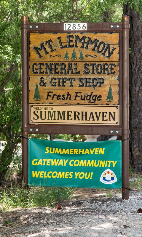
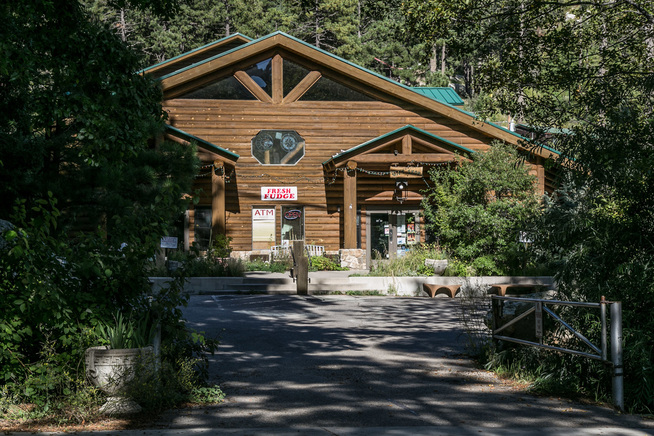
Regardless of whether you are staying in a cabin or camping, you will likely need provisions. One of your first stops in Summerhaven should be the General Store, which stocks food and supplies, as well as a great selection of gifts.
The store is located on the left hand side of the road after you pass the Community Center. They have an excellent website that is worth exploring before your trip. The site includes live video feeds outside their store and from Radio Ridge. They have the only ATM within 30 miles! And, don’t leave without trying their fudge!
|
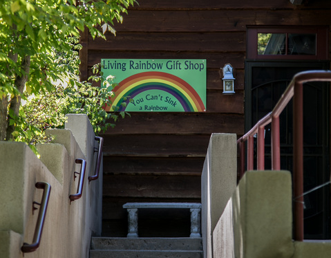
For gifts, postcards, that really neat tee-shirt, and to get the full Mt. Lemmon experience, you must visit the Living Rainbow Gift Shop, across the street from the General Store and just to the right of the Cookie Cabin. Meet Debbie Fagan, owner and living spirit of the Living Rainbow, who has lived on the mountain for over 30 years, and run the shop since 1979. The store was burned to the ground in the 2003 Aspen fire, but Debbie rebuilt it and is going stronger than ever. Prior to the fire she had collected 1 million beads from all over the world, which she used, and uses, to create wind chimes and various craft items. After the fire she carefully sifted through the rubble and recovered over 90% of them. Come visit, see beads that survived the fire, and find just the right gift for your family and friends, including children. Don’t miss it!
|
Food
There are three restaurants in town, plus the General Store, which has hot coffee, and typical groceries and supplies you might need for camping. Oh, and really awesome fudge!
The Sawmill Run Restaurant is located in the middle of Summerhaven, across from the Community Center, on the site of the original sawmill. The current hours and menu are on their website, , as well as a history of the site and restaurant. The food is excellent, with rotating specials. The fish and chips, when offered are great. Some of my favorites are the Spinach Salad with grilled chicken added, or Salmon if they have it – often an item during the summer. The meatloaf plate is fantastic, complete with mashed potatoes and brown gravy. Comfort food was never better! Call in advance to check on hours; they depend on the season and customer volume, with longer hours during the summer. Full bar and outside patio with views of the mountains to the south. They have free internet. Phone 520 576 9147.
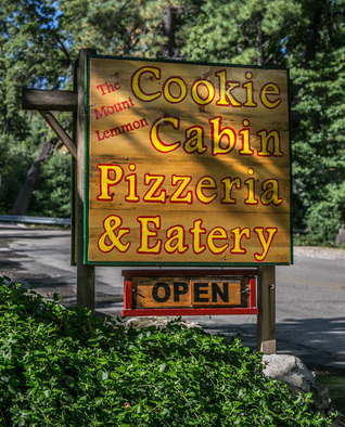
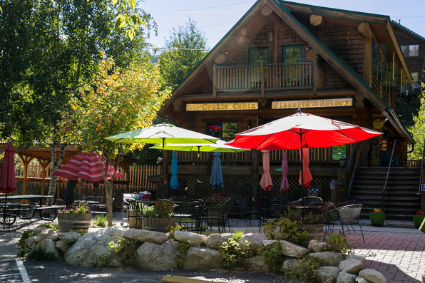
The Cookie Cabin is in Summerhaven, south (downhill toward Marshall Gulch) of the Community Center and The Sawmill Run, just past the General Store, on the right.
Rebuilt after the fire in 2003, they are open 10 am to 5 pm, with some indoor seating, and a very large and pleasant outdoor patio, where it is easy to park your kids and dogs. Order and pick up at the kitchen window inside. They offer pizza, by the slice or complete pie, barbecued chicken sandwiches, hot dogs, homemade chili, ice cream, cobbler and giant homemade cookies. A great place for informal dining during the day, especially if you are a large group.
The Iron Door is a classic restaurant of historic proportions located at Ski Valley, a ski area (I kid you not) close to the top of the mountain, and facing north. The turn off is to the right just before you swing south off of the highway into Summerhaven. They offer Breakfast and Lunch, in a German style. It is a great place for breakfast on the weekends, and a good place to meet locals, especially during the summer months. With breakfast on Saturday or Sunday you will get a free ride up and back on the chairlift. All their items are excellent, but my favorites are the Claim Jumper (thin sliced beef on a French roll) and Jay’s Chicken (grilled chicken breast on ciabatta with roasted red bell peppers). Definitely worth a stop for breakfast, lunch or just dessert! Call to check their hours; they vary by season and day of week: 520 576 1321.
Hiking and Camping
For general information on hiking and camping check out the US Forest Service website for the Coronado National Forest, and this one for the Santa Catalina Recreation Area. Note that there is a lake on the way to Summerhaven, Rose Canyon Lake, with picnicking and campsites. Here is a link to the Fee Schedule for the campsites.
Note that passes are required for parking and use of certain improved areas including Molino Basic Picnic area, Cypress picnic area, Middle Bear picnic area, Chihuahua Pine picnic area, Box Elder, Inspiration Rock, Alder Picnic areas, Loma Linda Picnic area, and Marshall Gulch picnic area. For more details, check with the Palisades Ranger Station, or click here for online content.
The General Store website is an excellent source of information about the mountain in general, including links to cabin rentals, the current weather, and live video feeds of the surroundings.
Some of my favorite spots
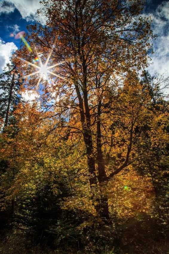
Bear Wallow is near milepost 22, not far from Summerhaven. It is a beautiful small valley that can be accessed from the parking lot for the Sunset trail, just off of the highway. It extends south and east to and under the highway, and climbs up in parallel to a road to Mt. Bigelow. It is easy to cross the highway – the trail goes under the highway through a huge culvert. The Wallow is home to maples, oaks, pines, and an occasional apple tree, and is a spectacular place to enjoy fall foliage in October. Great place to picnic. You can also park on E. Upper Bear Wallow Road that runs east off of the main highway at the culvert; just make sure you don’t block traffic. This is my preferred parking location, especially if I have brought my photo equipment, or lots of picnic supplies. Bring food and lots of water.
|
Marshall Gulch begins as you drive through Summerhaven on the Sabino Canyon Parkway heading south. The area is all U.S Forest Service land, and the southern parts of the road are closed to traffic during the winter. Sabino Creek runs by the road and into the gulch. Toward the south the gulch opens up. There are extensive picnicking facilities maintained by the Forest Service and vault toilets, but no potable water. Great area to picnic, go birding, or just decompress. Two trails begin near the restrooms: the Marshall Gulch Trail which winds west 1.2 miles to the Marshall Saddle, and the Aspen Trail which swings south and west 2.5 miles to join the Marshall Gulch Trail. The Aspen trail then continues up the mountain to radio ridge and the top of the Ski Valley chairlift. The Mint Springs Trail comes off of the Aspen Trail above the saddle, and winds north and east downhill back into Summerhaven. All great hikes with excellent views. Take lots of water.
Also from Marshall Gulch is the west end of the Sunset trail, an easy hike that ends at the highway, and close to Bear Wallow. Again, carry water, have a good map, be aware of your location at all times and allow time to get back to your car if you drove. |
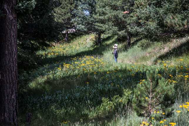
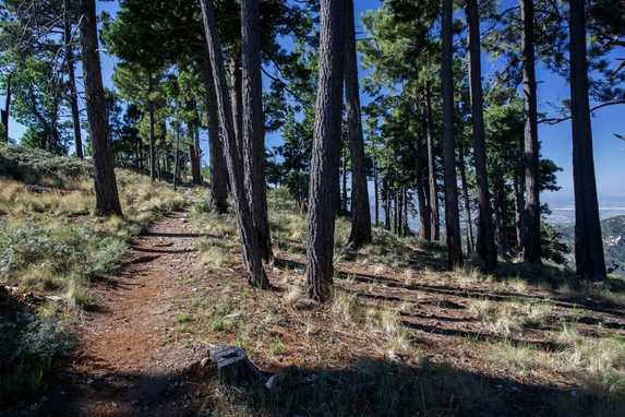
One of my favorites in July and August is the Meadow Trail on top of mountain, 1.2 miles past Ski Valley where the road ends, close to the gates of the Skycenter. It is an easy hike, and full of wildflowers during the summer months. Past the meadows it runs downhill through pine forests and connects with the Lemmon Trail, which can be taken back east to complete a loop. The total loop is 1.2 miles, and includes views of Tucson to the south, backdrop to the spectacular "Wilderness of Rocks."
|
Another favorite is the Incinerator Ridge Trail. It runs from the end of Incinerator Ridge Road (which you can find just downhill from Palisade Visitor Center) downhill south and east to the San Pedro Vista, at milepost 18. The higher parts of the trail have excellent views, with lot of birds. The trail is rocky in places, and hiking poles are helpful. The San Pedro Vista has a parking area, and spectacular views of the San Pedro Valley to the East. A great stop on your mountain drive regardless of whether or not you hike.
|
Birding and the Sky Center . . . .
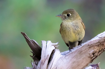
Mt. Lemmon is a great place for birding, as is most of Southern Arizona. August is considered a big month throughout the area, but anytime is good. Some species visit only for a week or two on their migration through the area. Check out the local Audubon Society for current activities. My Journal page has many entries on birds.
Another place to check out is the University of Arizona Sky Center. The Mt. Lemmon Skycenter is a science learning facility operated by the University of Arizona located at the Steward Observatory on the top of Mt. Lemmon. Their educational offerings include SkyNights, a night-time observing program using star charts, binoculars and the 32-inch Schulman telescope, the largest public dedicated telescope in the Southwest. The experience is offered almost every night throughout the year. For the more serious observer they offer AstronomerNights, allowing one or two visitors to work with an astronomer/guide with their 32-inch Schulman telescope. In addition they have workshops that immerse the visitor for several days and nights at their mountaintop facility for focused study of a topic in sciences or arts. Details are on their website.
Another place to check out is the University of Arizona Sky Center. The Mt. Lemmon Skycenter is a science learning facility operated by the University of Arizona located at the Steward Observatory on the top of Mt. Lemmon. Their educational offerings include SkyNights, a night-time observing program using star charts, binoculars and the 32-inch Schulman telescope, the largest public dedicated telescope in the Southwest. The experience is offered almost every night throughout the year. For the more serious observer they offer AstronomerNights, allowing one or two visitors to work with an astronomer/guide with their 32-inch Schulman telescope. In addition they have workshops that immerse the visitor for several days and nights at their mountaintop facility for focused study of a topic in sciences or arts. Details are on their website.
Things that drive the locals nuts!
All mountain residents are very sensitive to fire risk, regardless of the time of year. Smoking outside is considered a “no-no;” if you must smoke, do it in a car or house. If you are picnicking and barbecue, make sure fires are OK with the Forest Service. Some times of the year they are not, especially in our dry spring - usually April to early July - with June being a very high fire risk month. When you leave make sure the fire is out!
On the highway, pull off if you are going slowly and people are behind you! Even if you think you are going the speed limit, if you find a bumper-hugger in your rear view mirror, pull off at one of the many designated areas. Nothing is more aggravating than a conga line going up (or down) the mountain. And, don’t try to pass; the road is not straight enough to see ahead and pass safely.
Pick up your trash! Trash pick up is limited to the Forest Service bins located at their sites. If you cannot find a trash bin, put it in your car and “pack it out.” If you are sledding during one of our snowy winters, keep track of your gear and take it back with you. Every spring we find the winter left-overs which include parts of plastic sleds and miscellaneous articles of clothing.
